QGIS project and tools#
Administration project#
The algorithm Create database local interface creates a QGIS administration project
with all the layers, styles, labels and actions needed to visualize and edit the road network.
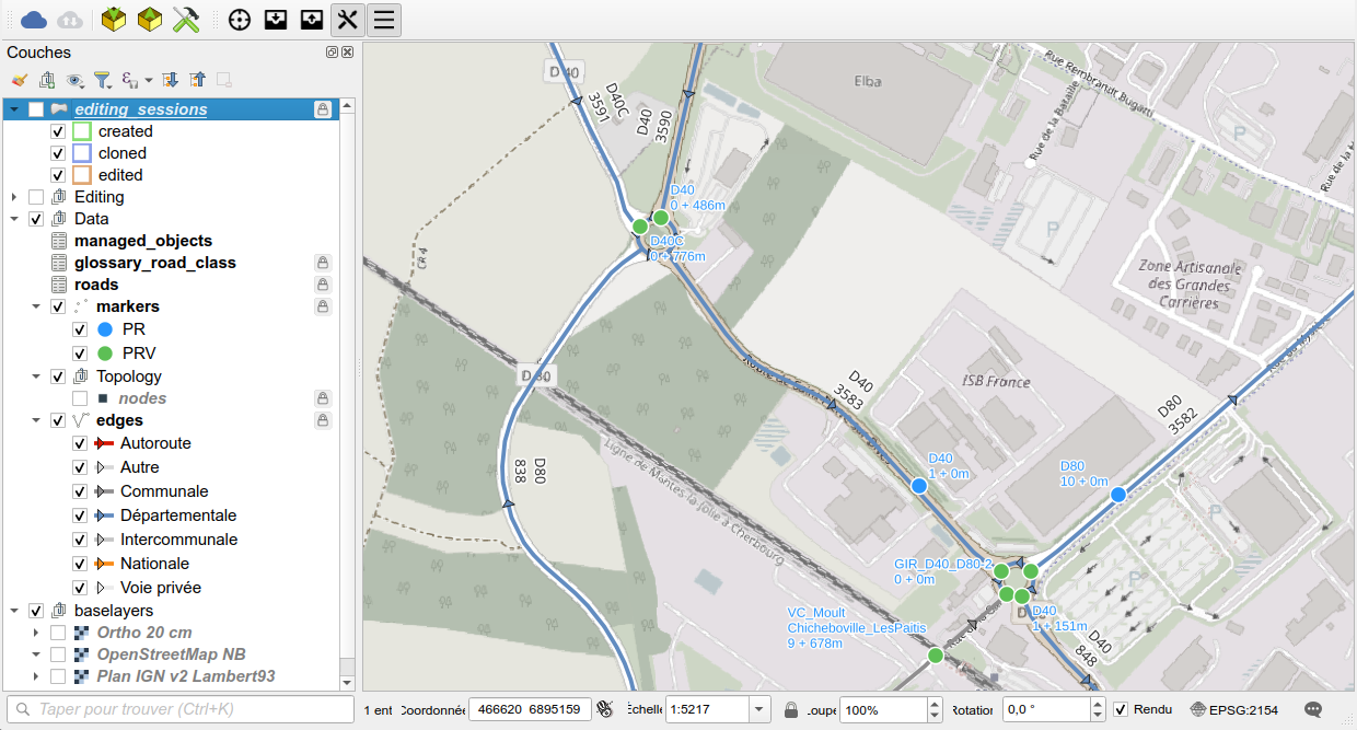
The project contains the following groups of layers:
editing_sessions: the areas of the editing sessions (created, cloned, edited), see Road graph editing,Editing: the layers of the editing session schemaroad_graph_editing,Data: the production datamanaged_objects: the list of business tables based on the road network, see Managed objects,glossary_road_classandroads,markers: reference points (PR) and virtual markers (PRV),Topology: thenodesandedges, styled by road class,
baselayers: the background maps.
Toolbar, menu and panels#
Toolbar#
The plugin adds the toolbar Road Network to QGIS:
| Button | Action |
|---|---|
Get references under the cursor |
Activates the map tool showing the references of the clicked point, see below. Shortcut: CTRL+SHIFT+K. |
Clone data to the editing sandbox |
Runs the algorithm Clone data to a new editing session, see Road graph editing |
Merge editing sandbox data |
Runs the algorithm Merge editing session data, see Road graph editing |
Show/hide the tools dock |
Shows or hides the panel RoadNetwork tools |
Show/hide the administration dock |
Shows or hides the panel RoadNetwork (administration) |
Menu#
The menu Plugins / RoadNetwork contains the actions Show/hide the tools dock,
Show/hide the administration dock, and Open online help, which opens this documentation.
Administration panel#
The panel RoadNetwork is used by the administrator to install and configure the database:
- the group
Informationshows the PostgreSQL connection used by the project, the versions of the plugin and of the database structure, and checks that they match. If the database structure is older than the plugin, it asks to run the algorithm Upgrade database structure, - the group
Install and configureruns the algorithmsConfigure plugin,Create database structure,Create database local interfaceandUpgrade database structure, - the group
Importruns the algorithm Import data from template.
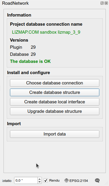
See Processing algorithms for the description of these algorithms.
Tools panel#
The panel RoadNetwork tools shows the references of a point, and allows to find a point from references:
- the group
Localisationconcerns the production data (schemaroad_graph), - the group
Localisation (editing)concerns the data of the current editing session (schemaroad_graph_editing): during an editing session, the references can be different from the production ones, - the group
Optionscontains the checkboxGet references on hover ?, which updates the references when the mouse moves over the map, see below.
Each Localisation group contains the fields Road, Marker, Abscissa, Cumulative, Offset and Side
(left or right), filled with the references of the point clicked or hovered on the map.
To find a point from references, type the road, the marker, the abscissa and, optionally,
the offset and the side, then click on Find or press Enter:
the map is centered on the corresponding point, which flashes.
Quick search#
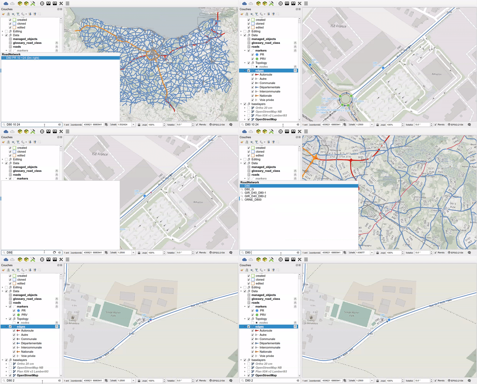
The QGIS locator search bar (CTRL+K) can be used to search a road or a position on a road.
No prefix is needed: the RoadNetwork results are displayed in the RoadNetwork group.
Type the road code and, optionally, the marker code, the abscissa, the offset and the side, separated by spaces:
D40: highlights the whole road,D40 1 151: centers the map on the pointD40 PR 1 + 151m,D40 1 151 3 left: same point, with an offset of3mon the left side.
Get references on map click#
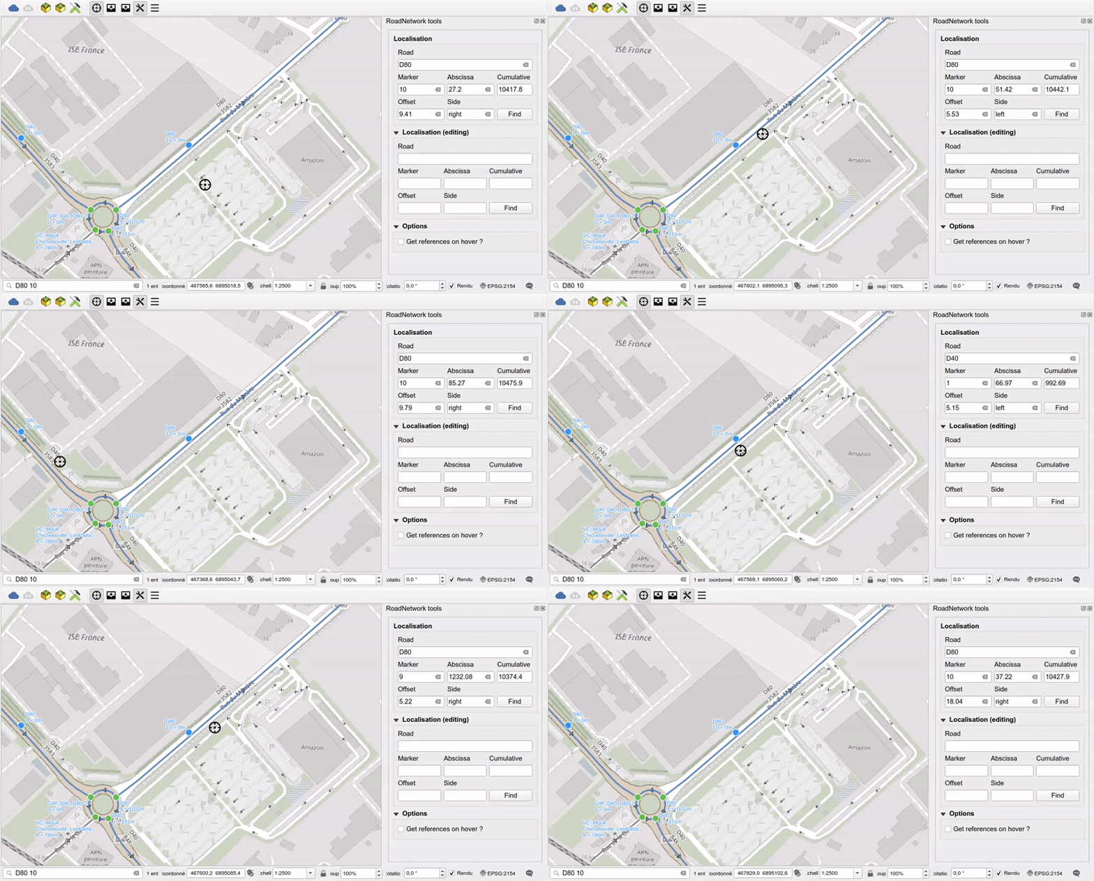
The tool Get references under the cursor shows the references of the point under the mouse:
road code, marker, abscissa, offset and side. It can be toggled with the plugin toolbar button
or with the shortcut CTRL+SHIFT+K. Hovering over the map is supported.
Layer actions#
Some layers of the project have actions, run by the RoadNetwork plugin, which must be installed and activated:
| Layer | Action | Usage |
|---|---|---|
editing_sessions |
Create editing session | Create a new editing session |
editing_sessions |
Display edited data | Highlight the objects modified in the session |
editing_sessions |
Drop editing session | Delete the session and its data |
edges copie |
Finalize the roundabout | Clean a roundabout digitized as a circle |
They are used when the user would like to modify the Road graph. See the corresponding documentation.
The layers of the road graph issues created by the algorithm Check the road graph also have actions,
to fix an issue with a right click: see Fix an issue with a right click.
To run an action on a feature, use the Identify Features tool and right-click on the feature in the map,
or use the Run Feature Action tool of the Attributes toolbar.
The Python code of these actions is stored in the plugin: the actions of the project only call it,
for example plugins['roadnetwork'].run_action('drop_editing_session', ...).