Presentation of the plugin concepts#
The RoadNetwork plugin helps to manage a topological county road network and to perform linear referencing with QGIS and PostGIS.
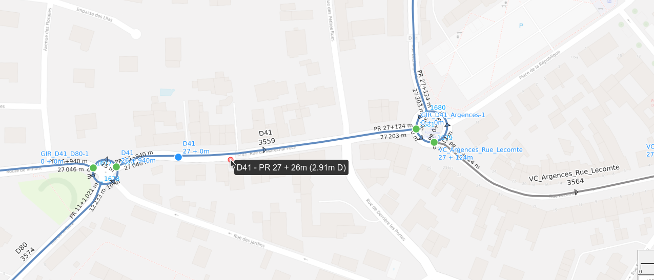
Road network#
Each road:
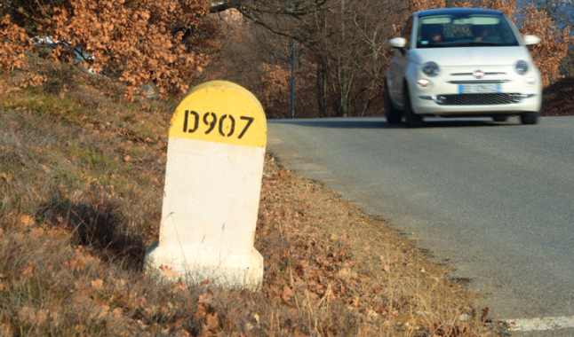
- has an identification, e.g.
D907, - is composed of a series of ordered edges (simple linestrings).
Markers are positioned along the roads. Their position is often measured with a GPS (X,Y).
Topology#
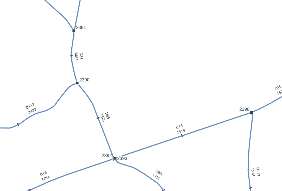
The road network is a graph built with edges and nodes:
- each edge has a start node and an end node,
- an edge can have a previous edge and a next edge,
- intersecting edges are cut by a node (if they are on the same level).
Position and references#
This simple organization of roads, edges and markers allows to determine the position of any object based on:
- a road code:
D902, - a marker code:
1, - an abscissa:
500m.
You can also provide an optional offset, e.g. 3m, and a side, e.g. left.
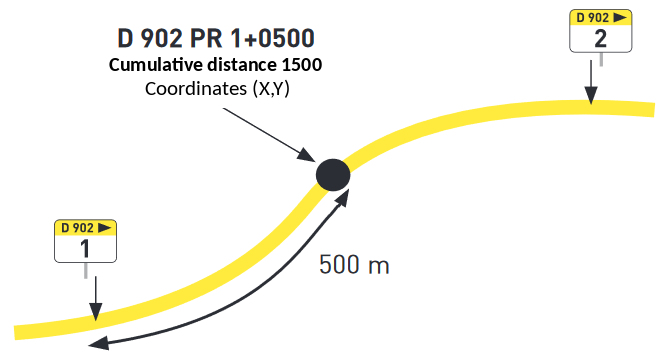
Any point within a distance of 50m of any road will have its references:
D902 PR 1 + 500m (3m left).
Linear referencing#
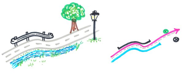
Each data object, point or (multi)linestring, is defined by its references calculated from the road network:
- Points: trees, street lights, car accidents, etc.
- Linestrings: paintings, safety barriers, roadworks, etc.
We must be able to:
- calculate the references from the object geometry,
- create a geometry based on given references:
- a point,
- a multi-linestring between two references.
Corner cases#
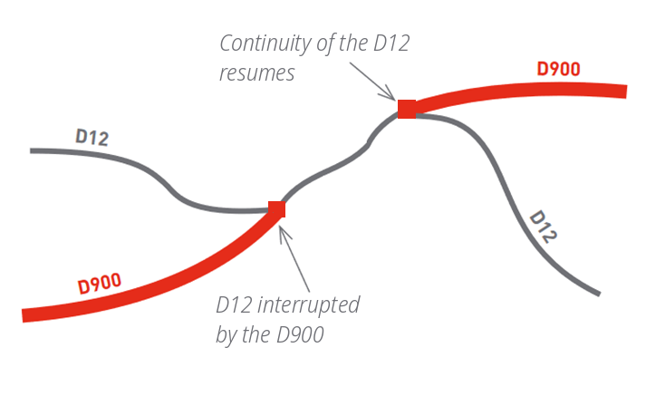
Discontinuity: edges could have been deleted (or have changed status).
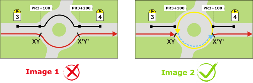
Roundabouts have their own road code, e.g. GIR D35-D80, and cut the other roads.
Glossary#
| Concept | Definition |
|---|---|
| Graph | A directed graph made of a set of edges and nodes representing the road network as a road centerline network, matching the axis of the carriageway. |
| Road | A consecutive sequence of edges forming a road / a way (e.g. D115). |
| Edge | Portion of a road. An edge is a directed segment linking two nodes (simple line). |
| Node | The nodes represent the start and end vertices of each edge. |
| Marker | Point created by the road network manager, physically materialized on the ground by painted marks associated with kilometer markers. |
| Virtual marker | Point created by the GIS administrator to make the administration of the graph easier, especially the computation of the reference point + abscissa. |
| Reference point (PR, point de repère) | Formerly known as kilometer point. |
| Business or thematic data | Set of thematic data overlaid on the graph and topologically linked to it. It can be point data (e.g. road signs) or linear data (e.g. pavement surface). |