Processing#
Run QuickOSM process with a raw query#
This algorithm launches all the QuickOSM process from a raw query. The url is built with the parameters, the file is downloaded and treated.
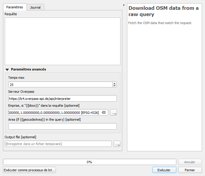
Parameters#
| ID | Description | Type | Info | Required | Advanced | Option |
|---|---|---|---|---|---|---|
| QUERY | Query | String | A XML or OQL query to be sent to the Overpass API. It can contain some {{}} tokens. | ✓ | ||
| TIMEOUT | Timeout | Integer | The timeout to use for the overpass api connexion | ✓ | ✓ | Default: 25 Type: Integer Min: 5.0, Max: 1.7976931348623157e+308 |
| EXTENT | Extent, if "{{bbox}}" in the query | Extent | If the query has a {{bbox}} token, this extent will be used for replacement. | ✓ | ||
| SERVER | Overpass server | String | The Overpass API server to use to build the encoded URL. | ✓ | ✓ | Default: https://lz4.overpass-api.de/api/interpreter |
| AREA | Area (if you want to override {{geocodeArea}} in the query) | String | The query is generated in the OQL format. | ✓ | ||
| FILE | Output file | String | Path to a geoPackage where the result will be saved |
Outputs#
| ID | Description | Type | Info |
|---|---|---|---|
| OUTPUT_POINTS | Layer with a point geometry | QgsVectorLayer | |
| OUTPUT_LINES | Layer with a line geometry | QgsVectorLayer | |
| OUTPUT_MULTILINESTRINGS | Layer with a multi line geometry | QgsVectorLayer | |
| OUTPUT_MULTIPOLYGONS | Layer with a polygon geometry | QgsVectorLayer |
Run QuickOSM process with a not spatial query#
This algorithm launches all the QuickOSM process from a not spatial query. The url is built with the parameters, the file is downloaded and treated.
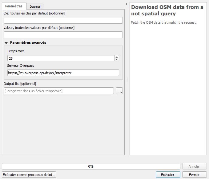
Parameters#
| ID | Description | Type | Info | Required | Advanced | Option |
|---|---|---|---|---|---|---|
| KEY | Key, default to all keys | String | The OSM key to use. It can be empty and it will default to all keys. | |||
| VALUE | Value, default to all values | String | The OSM value to use. It can be empty and it will default to all values. | |||
| TIMEOUT | Timeout | Integer | The timeout to use for the overpass api connexion | ✓ | ✓ | Default: 25 Type: Integer Min: 5.0, Max: 1.7976931348623157e+308 |
| SERVER | Overpass server | String | The Overpass API server to use to build the encoded URL. | ✓ | ✓ | Default: https://lz4.overpass-api.de/api/interpreter |
| FILE | Output file | String | Path to a geoPackage where the result will be saved |
Outputs#
| ID | Description | Type | Info |
|---|---|---|---|
| OUTPUT_POINTS | Layer with a point geometry | QgsVectorLayer | |
| OUTPUT_LINES | Layer with a line geometry | QgsVectorLayer | |
| OUTPUT_MULTILINESTRINGS | Layer with a multi line geometry | QgsVectorLayer | |
| OUTPUT_MULTIPOLYGONS | Layer with a polygon geometry | QgsVectorLayer |
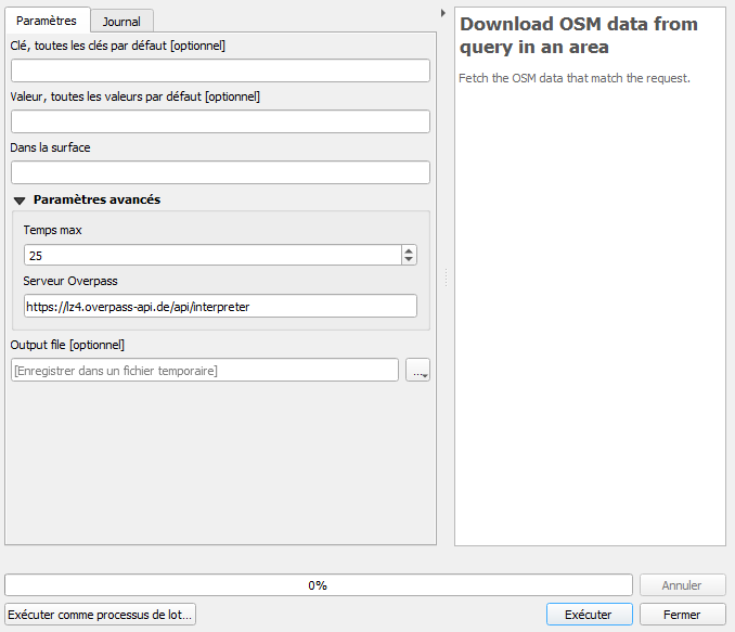
Run QuickOSM process with an 'in area' query#
This algorithm launches all the QuickOSM process from an 'in area' query. The url is built with the parameters, the file is downloaded and treated.
Parameters#
| ID | Description | Type | Info | Required | Advanced | Option |
|---|---|---|---|---|---|---|
| KEY | Key, default to all keys | String | The OSM key to use. It can be empty and it will default to all keys. | |||
| VALUE | Value, default to all values | String | The OSM value to use. It can be empty and it will default to all values. | |||
| AREA | Around the area | String | The name of a place, a first query to the Nominatim API will be executed to fetch the OSM ID. A WKT Point string is accepted as well. | ✓ | ||
| TIMEOUT | Timeout | Integer | The timeout to use for the overpass api connexion | ✓ | ✓ | Default: 25 Type: Integer Min: 5.0, Max: 1.7976931348623157e+308 |
| SERVER | Overpass server | String | The Overpass API server to use to build the encoded URL. | ✓ | ✓ | Default: https://lz4.overpass-api.de/api/interpreter |
| FILE | Output file | String | Path to a geoPackage where the result will be saved |
Outputs#
| ID | Description | Type | Info |
|---|---|---|---|
| OUTPUT_POINTS | Layer with a point geometry | QgsVectorLayer | |
| OUTPUT_LINES | Layer with a line geometry | QgsVectorLayer | |
| OUTPUT_MULTILINESTRINGS | Layer with a multi line geometry | QgsVectorLayer | |
| OUTPUT_MULTIPOLYGONS | Layer with a polygon geometry | QgsVectorLayer |
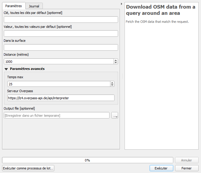
Run QuickOSM process with an 'around area' query#
This algorithm launches all the QuickOSM process from an 'around area' query. The url is built with the parameters, the file is downloaded and treated.
Parameters#
| ID | Description | Type | Info | Required | Advanced | Option |
|---|---|---|---|---|---|---|
| KEY | Key, default to all keys | String | The OSM key to use. It can be empty and it will default to all keys. | |||
| VALUE | Value, default to all values | String | The OSM value to use. It can be empty and it will default to all values. | |||
| AREA | Around the area | String | The name of a place, a first query to the Nominatim API will be executed to fetch the OSM ID. A WKT Point string is accepted as well. | ✓ | ||
| DISTANCE | Distance (meters) | Number | The distance to use when doing the buffering around the named area. The distance must be in meters. | ✓ | Default: 1000 Type: Integer Min: 1.0, Max: 1.7976931348623157e+308 |
|
| TIMEOUT | Timeout | Integer | The timeout to use for the overpass api connexion | ✓ | ✓ | Default: 25 Type: Integer Min: 5.0, Max: 1.7976931348623157e+308 |
| SERVER | Overpass server | String | The Overpass API server to use to build the encoded URL. | ✓ | ✓ | Default: https://lz4.overpass-api.de/api/interpreter |
| FILE | Output file | String | Path to a geoPackage where the result will be saved |
Outputs#
| ID | Description | Type | Info |
|---|---|---|---|
| OUTPUT_POINTS | Layer with a point geometry | QgsVectorLayer | |
| OUTPUT_LINES | Layer with a line geometry | QgsVectorLayer | |
| OUTPUT_MULTILINESTRINGS | Layer with a multi line geometry | QgsVectorLayer | |
| OUTPUT_MULTIPOLYGONS | Layer with a polygon geometry | QgsVectorLayer |
Run QuickOSM process with an 'extent' query#
This algorithm launches all the QuickOSM process from an 'extent' query. The url is built with the parameters, the file is downloaded and treated.
Parameters#
| ID | Description | Type | Info | Required | Advanced | Option |
|---|---|---|---|---|---|---|
| KEY | Key, default to all keys | String | The OSM key to use. It can be empty and it will default to all keys. | |||
| VALUE | Value, default to all values | String | The OSM value to use. It can be empty and it will default to all values. | |||
| EXTENT | Extent | Extent | The extent as a rectangle to use when building the query. | ✓ | ||
| TIMEOUT | Timeout | Integer | The timeout to use for the overpass api connexion | ✓ | ✓ | Default: 25 Type: Integer Min: 5.0, Max: 1.7976931348623157e+308 |
| SERVER | Overpass server | String | The Overpass API server to use to build the encoded URL. | ✓ | ✓ | Default: https://lz4.overpass-api.de/api/interpreter |
| FILE | Output file | String | Path to a geoPackage where the result will be saved |
Outputs#
| ID | Description | Type | Info |
|---|---|---|---|
| OUTPUT_POINTS | Layer with a point geometry | QgsVectorLayer | |
| OUTPUT_LINES | Layer with a line geometry | QgsVectorLayer | |
| OUTPUT_MULTILINESTRINGS | Layer with a multi line geometry | QgsVectorLayer | |
| OUTPUT_MULTIPOLYGONS | Layer with a polygon geometry | QgsVectorLayer |
Advanced#
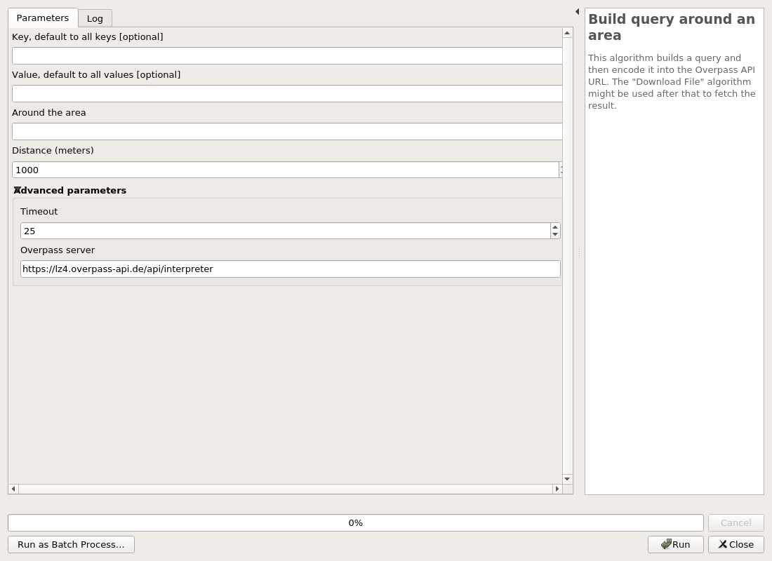
Build query around an area#
This algorithm builds a query and then encode it into the Overpass API URL. The "Download File" algorithm might be used after that to fetch the result.
Parameters#
| ID | Description | Type | Info | Required | Advanced | Option |
|---|---|---|---|---|---|---|
| KEY | Key, default to all keys | String | The OSM key to use. It can be empty and it will default to all keys. | |||
| VALUE | Value, default to all values | String | The OSM value to use. It can be empty and it will default to all values. | |||
| AREA | Around the area | String | The name of a place, a first query to the Nominatim API will be executed to fetch the OSM ID. A WKT Point string is accepted as well. | ✓ | ||
| DISTANCE | Distance (meters) | Number | The distance to use when doing the buffering around the named area. The distance must be in meters. | ✓ | Default: 1000 Type: Integer Min: 1.0, Max: 1.7976931348623157e+308 |
|
| TIMEOUT | Timeout | Number | The timeout to use for the Overpass API. | ✓ | ✓ | Default: 25 Type: Integer Min: 5.0, Max: 1.7976931348623157e+308 |
| SERVER | Overpass server | String | The Overpass API server to use to build the encoded URL. | ✓ | ✓ | Default: https://lz4.overpass-api.de/api/interpreter |
Outputs#
| ID | Description | Type | Info |
|---|---|---|---|
| OUTPUT_URL | Query as encoded URL | String | The query is generated and encoded with the Overpass API URL. This output should be used in the File Downloader algorithm. |
| OUTPUT_OQL_QUERY | Raw query as OQL | String | The query is generated in the OQL format. |
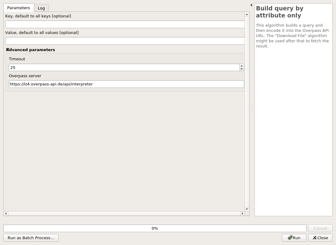
Build query by attribute only#
This algorithm builds a query and then encode it into the Overpass API URL. The "Download File" algorithm might be used after that to fetch the result.
Parameters#
| ID | Description | Type | Info | Required | Advanced | Option |
|---|---|---|---|---|---|---|
| KEY | Key, default to all keys | String | The OSM key to use. It can be empty and it will default to all keys. | |||
| VALUE | Value, default to all values | String | The OSM value to use. It can be empty and it will default to all values. | |||
| TIMEOUT | Timeout | Number | The timeout to use for the Overpass API. | ✓ | ✓ | Default: 25 Type: Integer Min: 5.0, Max: 1.7976931348623157e+308 |
| SERVER | Overpass server | String | The Overpass API server to use to build the encoded URL. | ✓ | ✓ | Default: https://lz4.overpass-api.de/api/interpreter |
Outputs#
| ID | Description | Type | Info |
|---|---|---|---|
| OUTPUT_URL | Query as encoded URL | String | The query is generated and encoded with the Overpass API URL. This output should be used in the File Downloader algorithm. |
| OUTPUT_OQL_QUERY | Raw query as OQL | String | The query is generated in the OQL format. |
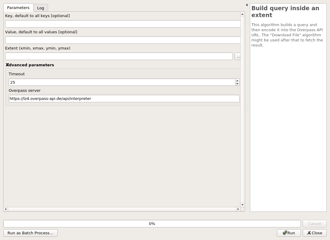
Build query inside an extent#
This algorithm builds a query and then encode it into the Overpass API URL. The "Download File" algorithm might be used after that to fetch the result.
Parameters#
| ID | Description | Type | Info | Required | Advanced | Option |
|---|---|---|---|---|---|---|
| KEY | Key, default to all keys | String | The OSM key to use. It can be empty and it will default to all keys. | |||
| VALUE | Value, default to all values | String | The OSM value to use. It can be empty and it will default to all values. | |||
| EXTENT | Extent | Extent | The extent as a rectangle to use when building the query. | ✓ | ||
| TIMEOUT | Timeout | Number | The timeout to use for the Overpass API. | ✓ | ✓ | Default: 25 Type: Integer Min: 5.0, Max: 1.7976931348623157e+308 |
| SERVER | Overpass server | String | The Overpass API server to use to build the encoded URL. | ✓ | ✓ | Default: https://lz4.overpass-api.de/api/interpreter |
Outputs#
| ID | Description | Type | Info |
|---|---|---|---|
| OUTPUT_URL | Query as encoded URL | String | The query is generated and encoded with the Overpass API URL. This output should be used in the File Downloader algorithm. |
| OUTPUT_OQL_QUERY | Raw query as OQL | String | The query is generated in the OQL format. |
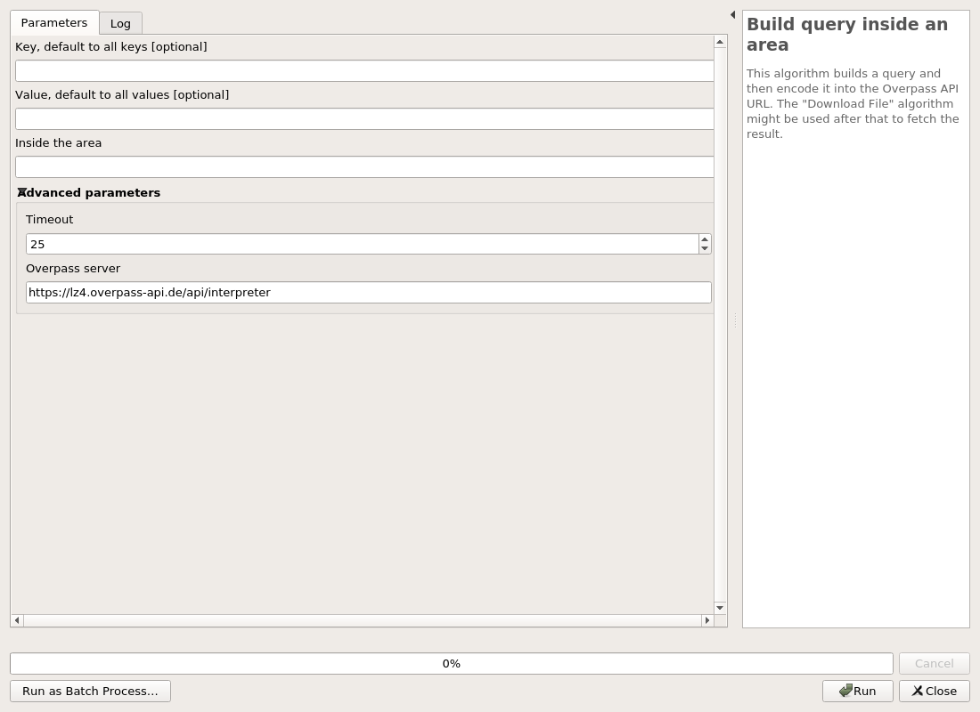
Build query inside an area#
This algorithm builds a query and then encode it into the Overpass API URL. The "Download File" algorithm might be used after that to fetch the result.
Parameters#
| ID | Description | Type | Info | Required | Advanced | Option |
|---|---|---|---|---|---|---|
| KEY | Key, default to all keys | String | The OSM key to use. It can be empty and it will default to all keys. | |||
| VALUE | Value, default to all values | String | The OSM value to use. It can be empty and it will default to all values. | |||
| AREA | Inside the area | String | The name of the area. This will make a first query to the Nominatim API to fetch the OSM ID. | ✓ | ||
| TIMEOUT | Timeout | Number | The timeout to use for the Overpass API. | ✓ | ✓ | Default: 25 Type: Integer Min: 5.0, Max: 1.7976931348623157e+308 |
| SERVER | Overpass server | String | The Overpass API server to use to build the encoded URL. | ✓ | ✓ | Default: https://lz4.overpass-api.de/api/interpreter |
Outputs#
| ID | Description | Type | Info |
|---|---|---|---|
| OUTPUT_URL | Query as encoded URL | String | The query is generated and encoded with the Overpass API URL. This output should be used in the File Downloader algorithm. |
| OUTPUT_OQL_QUERY | Raw query as OQL | String | The query is generated in the OQL format. |
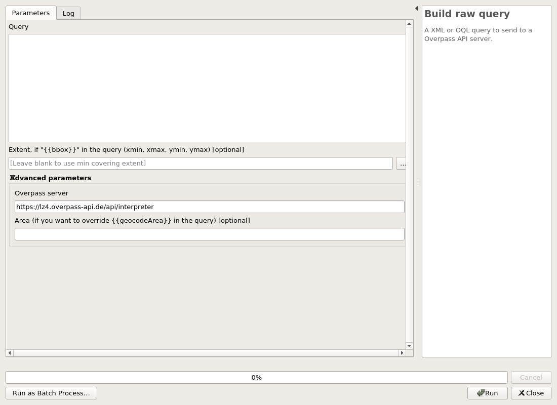
Build raw query#
A XML or OQL query to send to a Overpass API server.
Parameters#
| ID | Description | Type | Info | Required | Advanced | Option |
|---|---|---|---|---|---|---|
| QUERY | Query | String | A XML or OQL query to be sent to the Overpass API. It can contains some {{}} tokens. | ✓ | ||
| EXTENT | Extent, if "{{bbox}}" in the query | Extent | If the query has a {{bbox}} token, this extent will be used for replacement. | |||
| SERVER | Overpass server | String | The Overpass API server to use to build the encoded URL. | ✓ | ✓ | Default: https://lz4.overpass-api.de/api/interpreter |
| AREA | Area (if you want to override {{geocodeArea}} in the query) | String | The query is generated in the OQL format. | ✓ |
Outputs#
| ID | Description | Type | Info |
|---|---|---|---|
| OUTPUT_URL | Query as encoded URL | String | |
| OUTPUT_OQL_QUERY | Raw query as OQL | String |
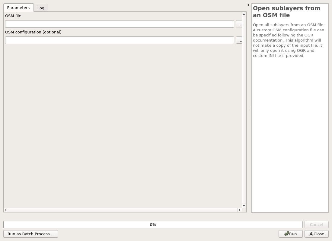
Open sublayers from an OSM file#
Open all sublayers from an OSM file. A custom OSM configuration file can be specified following the OGR documentation. This algorithm will not make a copy of the input file, it will only open it using OGR and custom INI file if provided.
Parameters#
| ID | Description | Type | Info | Required | Advanced | Option |
|---|---|---|---|---|---|---|
| FILE | OSM file | File | The extension can be a OSM or PBF file. | ✓ | ||
| OSM_CONF | OSM configuration | File | The OGR OSM configuration file. This file is used to customize the import process about OSM tags. You should read the OGR documentation https://gdal.org/drivers/vector/osm.html |
Outputs#
| ID | Description | Type | Info |
|---|---|---|---|
| OUTPUT_POINTS | Output points | VectorLayer | The point layer from the OGR OSM driver. |
| OUTPUT_LINES | Output lines | VectorLayer | The line layer from the OGR OSM driver. |
| OUTPUT_MULTILINESTRINGS | Output multilinestrings | VectorLayer | The multilinestrings layer from the OGR OSM driver. |
| OUTPUT_MULTIPOLYGONS | Output multipolygons | VectorLayer | The multipolygon layer from the OGR OSM driver. |
| OUTPUT_OTHER_RELATIONS | Output other relations | VectorLayer | The relation layer from the OGR OSM driver. |