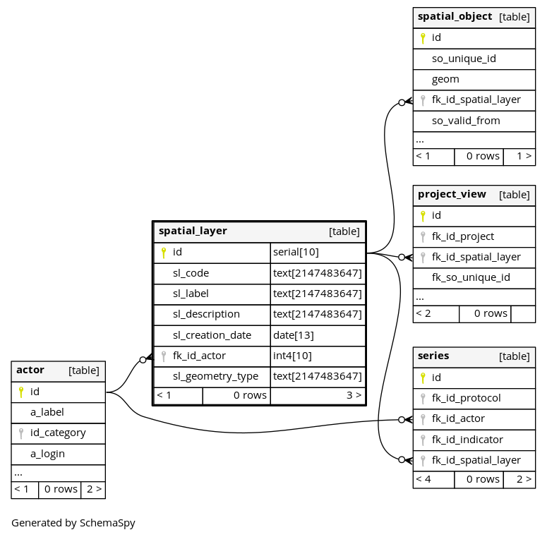
Columns
| Column | Type | Size | Nulls | Auto | Default | Children | Parents | Comments | ||||||
|---|---|---|---|---|---|---|---|---|---|---|---|---|---|---|
| id | serial | 10 | √ | nextval('gobs.spatial_layer_id_seq'::regclass) |
|
|
||||||||
| sl_code | text | 2147483647 | null |
|
|
Unique short code for the spatial layer |
||||||||
| sl_label | text | 2147483647 | null |
|
|
Label of the spatial layer |
||||||||
| sl_description | text | 2147483647 | null |
|
|
Description |
||||||||
| sl_creation_date | date | 13 | (now())::date |
|
|
Creation date |
||||||||
| sl_geometry_type | text | 2147483647 | null |
|
|
Type of geometry (POINT, POLYGON, MULTIPOLYGON, etc.) |
Indexes
| Constraint Name | Type | Sort | Column(s) |
|---|---|---|---|
| spatial_layer_pkey | Primary key | Asc | id |
| spatial_layer_sl_code_idx | Performance | Asc | sl_code |
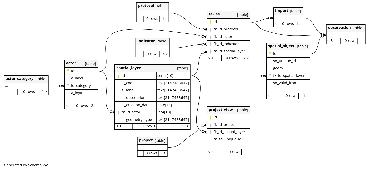
Relationships
Close relationships within degrees of separation