PgMetadata#
Short introduction#
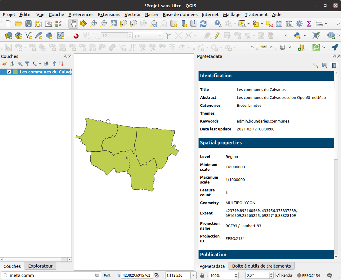
It's a QGIS plugin to store some metadata for PostgreSQL layers inside a PostgreSQL database 🐘.
Metadata for a PostgreSQL table includes :
- a title
- an abstract
- keywords
- categories and themes
- spatial properties such as extent, feature count, projection, scales
- 0 or many contacts with a role
- 0 or many links
- …
Some key features for final users :
- a locator to easy search and add layers
- a dock to display metadata
- Export a single sheet to PDF, HTML DCAT
- Export the full catalog
Some features for the GIS administrator :
- A QGIS project designed to manage the metadata.
- Some views are included to detect some orphaned tables.
- Customization of the HTML template
To help, there are some videos tutorials.
Description#
PgMetadata is made for people using QGIS as their main GIS application, and PostgreSQL 🐘 as their main vector data storage.
The metadata of layers are stored inside your PostgreSQL database, in a dedicated schema. Classical fields are supported, such as the title, description, categories, themes, links, and the spatial properties of your data: extent, projection, etc.
PgMetadata is not designed as a catalog application which lets you search among datasets and then download the data. It is designed to ease the use of the metadata inside QGIS, allowing to search for a data and open the corresponding layer, or to view the metadata of the already loaded PostgreSQL layers.
By storing the metadata of the vector tables inside the database:
- QGIS can read the metadata easily by using the layer PostgreSQL connection: a dock shows the metadata for the active layer when the plugin detects metadata exists for this QGIS layer.
- QGIS can run SQL queries: you can use the QGIS locator search bar to search for a layer, and load it easily in your project.
The administrator in charge of editing the metadata will also benefit from the PostgreSQL storage:
- PostgreSQL/PostGIS functions are used to automatically update some fields based on the table data (the layer extent, geometry type, feature count, projection, etc.).
- The metadata is saved with your data anytime you backup the database.
- You do not need to share XML files across the network or install a new catalog application to manage your metadata and allow the users to get it. Only PostgreSQL is needed.
The plugin contains some processing algorithms to help the administrator. For example:
- a script helps to create or update the needed
pgmetadataPostgreSQL schema and tables in your database. - a algorithm creates a QGIS project suitable for the metadata editing. This project uses the power of QGIS to create a rich user interface allowing to edit your metadata easily (forms, relations). Why use another interface when QGIS rocks ?
More PgMetadata features:
- Modification of the HTML template to tune the displayed metadata
- Export a metadata sheet to PDF, HTML or DCAT
- Publish the metadata as a DCAT catalog with the Lizmap Web Client module for PgMetadata. It can then be harvested by external applications (Geonetwork, CKAN)
- The data model is very close to the QGIS metadata storage and the DCAT vocabulary for compatibility.