## 3liz
* **QGIS** and **PostgreSQL** lovers
* QGIS **core** contributors (mainly server)
* 8 employees
* QGIS / QGIS Server / PostgreSQL / Lizmap
* **Open Source** forever
* Development, server hosting, consulting, support, training

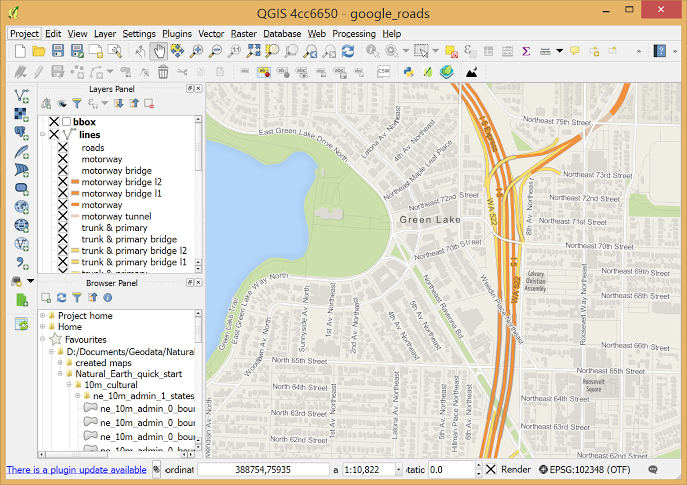
## QGIS - The Leading Open Source Desktop GIS

QGIS is a professional GIS application that is built on top of and proud to be itself Free and Open Source Software .
## QGIS
* Was a **simple** PostgreSQL/PostGIS **viewer**
* Licensed under the **GNU General Public License**
* Project of the **Open Source Geospatial Foundation** (OSGeo)
* Runs on Linux, Unix, Mac OSX, Windows and Android
* Supports **numerous** vector, raster, and database **formats** and **functionalities**.
QGIS Sustainers
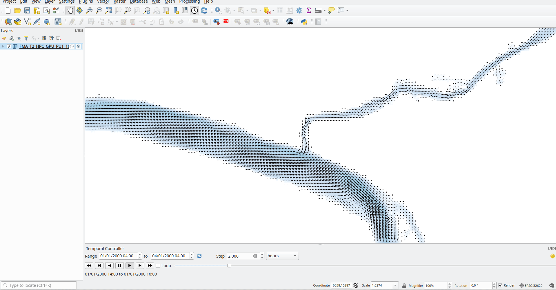
 ## QGIS is not only a Desktop app
* **QGIS Server** as an OGC Data Server
* **QGIS processing** console tool
* **QField** a mobile [Q]GIS solution

## Need to publish web maps ?
* You already **use and love QGIS** as your main GIS tool
* You need to publish **full-featured applications** to the web
* You have **no time** to set up and configure web maps in **complex admin panels** nor reinventing the wheel
## Lizmap ♥ QGIS
* The **QGIS desktop project** is your **web map configuration**: symbology, printing composers, attribute tables, editing forms, expressions, etc.
* As **QField**, Prepare once deploy everywhere
* **Lizmap QGIS plugin**: configure only specific map options (scales, available tools)
* **Web admin panel** mainly for **authentication and authorization management** (users & groups)
* It is **open-source**: Mozilla Public Licence

## History
* Created in **2011** as simple QGIS project viewer
* Based on **QGIS Server** and **OGC standards**: WMS, WFS, WMTS, WPS
* Has evolved to a **full-featured** web gis application generator by integrating many great **QGIS features**: symbology, relations, printing, etc.

## How-to publish a web map application:
* Create and set up your **QGIS project** (e.g. layers and server properties)
* Use **Lizmap plugin** to configure the map options and tools (extent, scales, ...)
* **Send** your QGIS project, lizmap configuration, data and others files **to the server**
**\o/** You've got a web map based on this QGIS project **\o/**
## Use cases
### Some examples to demonstrate
### the main features
## Meylan - map catalog
* French city in the Alps
* Publish thematic maps for citizens
* Eye-candy, with a focus on simplicity
## Calvados - Custom theme
* French department of Normandy
* Publish thematic maps for citizens
* Promoting landscapes
## Aduga - Popups
### Identify an object
* **Urban planning agency**
* Highlight key figures of **local business parks**
* Use **Lizmap HTML popup** with QGIS tooltip & expressions
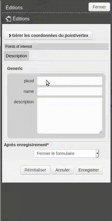
## Edition - Faunal observations
* QGIS field **edit widgets**
* QGIS Form **drag&drop** conception
* **Draw** geometry - **GPS** use capabilities to draw
* Edition **rights**
## Borbonica - Dataviz
* La Réunion **National park** (Indian ocean)
* Publish a **dashboard** on plant and animal observation data
* Use Lizmap **dataviz module** with PostgreSQL views
## Cats - relations and atlas
* **Movebank** public dataset on **domestic cats** positions
* Show **relations between layers** data
* Use **QGIS relations** in the project properties dialog
* Add **attribute tables** in Lizmap plugin for these layers
* Iterate over cats with **atlas tool**

## Grand Narbonne - find local products
* Promoting locally sourced
* Promoting local shops
* Promoting local products
## Cadastre - business application
* **French Britanny** group of cities: Centre Morbihan Communauté
* Search **parcels** by location or owner information
* Dedicated **Cadastre Lizmap modules** with a **QGIS Server Python plugin**
* Lizmap native **access control** to protect sensitive data
## A growing community
* Different types of users
* private companies
* public organizations
* research centers
* Main contribution in **translation and documentation**
* JS scripts repository contributions
* Bug triaging


## Freely usable and used
* Bonelli eagle 2017-2019 http://lizmap.aigledebonelli.fr/websig/lizmap/www/
* Indian ocean environment survey http://homisland.seas-oi.org/
* IRSTEA Earth Observation: https://mdl4eo-cartes.irstea.fr
* Georice, South-East Asia: http://georice.net/lm/
* Faunalia (Italie) https://lizmap.faunalia.eu/
* Consorzio Toscana Nord (Italy) http://geoportale.cbtoscananord.it
* Live QField users map: http://demo.qfield.org/websig/lizmap/www/
* Município de Arraiolos (Portugal) http://pdm-revisao.municipioarraiolos.pt/
* SAERI (South Atlantic): https://data.saeri.org/saeri_webgis/lizmap/www/
## Extensibility
* Server sides modules
* User Javascript scripts
* CSS themes
* Map Builder module
* HTML powered : iframes, video/audio, etc.
## Next Lizmap release : 3.4
* Use QGIS **Expression** in Lizmap Edition
* default value, constraints, drill down, fields group display
* **Snapping** while editing
* **Geolocation** survey
* Improvements in **dataviz**
* Lizmap plugin as a QGIS Server **access control** plugin
## Lizmap RFC
* Lizmap Web Client **version 4**
* OpenLayers **5 or 6**
* **ECMAScript** 6 or 2016+
* W3C **Web Components**
* **Unidirectional** User Interface Architecture
* **Bootstrap** 5
* Remove **Jquery** 3
## W3C Web Components
* We would like to use **native W3C Web Components** to:
* limit the **size** of our source code
* limit the **dependancies** to "cool" frameworks
* benefit from web browser **native performances**
* We think that:
* the dependancy to OpenLayers is already **big enough**
* **standard** technologies are **sustainables**: 10 years old HTML/CSS/JS codes still works!
# Links
* Demo: https://demo.lizmap.com
* Website: https://lizmap.com
* Documentation https://doc.lizmap.com
* docker-compose https://github.com/3liz/lizmap-docker-compose
* To contribute
* RFC: https://github.com/3liz/lizmap-rfc
* web-client https://github.com/3liz/lizmap-web-client
* plugin https://github.com/3liz/lizmap-plugin
* documentation https://github.com/3liz/lizmap-documentation
* localizing https://www.transifex.com/3liz-1/
## QGIS is not only a Desktop app
* **QGIS Server** as an OGC Data Server
* **QGIS processing** console tool
* **QField** a mobile [Q]GIS solution

## Need to publish web maps ?
* You already **use and love QGIS** as your main GIS tool
* You need to publish **full-featured applications** to the web
* You have **no time** to set up and configure web maps in **complex admin panels** nor reinventing the wheel

## Lizmap ♥ QGIS
* The **QGIS desktop project** is your **web map configuration**: symbology, printing composers, attribute tables, editing forms, expressions, etc.
* As **QField**, Prepare once deploy everywhere
* **Lizmap QGIS plugin**: configure only specific map options (scales, available tools)
* **Web admin panel** mainly for **authentication and authorization management** (users & groups)
* It is **open-source**: Mozilla Public Licence

## History
* Created in **2011** as simple QGIS project viewer
* Based on **QGIS Server** and **OGC standards**: WMS, WFS, WMTS, WPS
* Has evolved to a **full-featured** web gis application generator by integrating many great **QGIS features**: symbology, relations, printing, etc.

## How-to publish a web map application:
* Create and set up your **QGIS project** (e.g. layers and server properties)
* Use **Lizmap plugin** to configure the map options and tools (extent, scales, ...)
* **Send** your QGIS project, lizmap configuration, data and others files **to the server**
**\o/** You've got a web map based on this QGIS project **\o/**
## Use cases
### Some examples to demonstrate
### the main features
## Meylan - map catalog
* French city in the Alps
* Publish thematic maps for citizens
* Eye-candy, with a focus on simplicity
## Calvados - Custom theme
* French department of Normandy
* Publish thematic maps for citizens
* Promoting landscapes
## Aduga - Popups
### Identify an object
* **Urban planning agency**
* Highlight key figures of **local business parks**
* Use **Lizmap HTML popup** with QGIS tooltip & expressions
## Edition - Faunal observations
* QGIS field **edit widgets**
* QGIS Form **drag&drop** conception
* **Draw** geometry - **GPS** use capabilities to draw
* Edition **rights**
## Borbonica - Dataviz
* La Réunion **National park** (Indian ocean)
* Publish a **dashboard** on plant and animal observation data
* Use Lizmap **dataviz module** with PostgreSQL views
## Cats - relations and atlas
* **Movebank** public dataset on **domestic cats** positions
* Show **relations between layers** data
* Use **QGIS relations** in the project properties dialog
* Add **attribute tables** in Lizmap plugin for these layers
* Iterate over cats with **atlas tool**

## Grand Narbonne - find local products
* Promoting locally sourced
* Promoting local shops
* Promoting local products
## Cadastre - business application
* **French Britanny** group of cities: Centre Morbihan Communauté
* Search **parcels** by location or owner information
* Dedicated **Cadastre Lizmap modules** with a **QGIS Server Python plugin**
* Lizmap native **access control** to protect sensitive data
## A growing community
* Different types of users
* private companies
* public organizations
* research centers
* Main contribution in **translation and documentation**
* JS scripts repository contributions
* Bug triaging


## Freely usable and used
* Bonelli eagle 2017-2019 http://lizmap.aigledebonelli.fr/websig/lizmap/www/
* Indian ocean environment survey http://homisland.seas-oi.org/
* IRSTEA Earth Observation: https://mdl4eo-cartes.irstea.fr
* Georice, South-East Asia: http://georice.net/lm/
* Faunalia (Italie) https://lizmap.faunalia.eu/
* Consorzio Toscana Nord (Italy) http://geoportale.cbtoscananord.it
* Live QField users map: http://demo.qfield.org/websig/lizmap/www/
* Município de Arraiolos (Portugal) http://pdm-revisao.municipioarraiolos.pt/
* SAERI (South Atlantic): https://data.saeri.org/saeri_webgis/lizmap/www/
## Extensibility
* Server sides modules
* User Javascript scripts
* CSS themes
* Map Builder module
* HTML powered : iframes, video/audio, etc.
## Next Lizmap release : 3.4
* Use QGIS **Expression** in Lizmap Edition
* default value, constraints, drill down, fields group display
* **Snapping** while editing
* **Geolocation** survey
* Improvements in **dataviz**
* Lizmap plugin as a QGIS Server **access control** plugin

## Lizmap RFC
* Lizmap Web Client **version 4**
* OpenLayers **5 or 6**
* **ECMAScript** 6 or 2016+
* W3C **Web Components**
* **Unidirectional** User Interface Architecture
* **Bootstrap** 5
* Remove **Jquery** 3
## W3C Web Components
* We would like to use **native W3C Web Components** to:
* limit the **size** of our source code
* limit the **dependancies** to "cool" frameworks
* benefit from web browser **native performances**
* We think that:
* the dependancy to OpenLayers is already **big enough**
* **standard** technologies are **sustainables**: 10 years old HTML/CSS/JS codes still works!
# Links
* Demo: https://demo.lizmap.com
* Website: https://lizmap.com
* Documentation https://doc.lizmap.com
* docker-compose https://github.com/3liz/lizmap-docker-compose
* To contribute
* RFC: https://github.com/3liz/lizmap-rfc
* web-client https://github.com/3liz/lizmap-web-client
* plugin https://github.com/3liz/lizmap-plugin
* documentation https://github.com/3liz/lizmap-documentation
* localizing https://www.transifex.com/3liz-1/